|
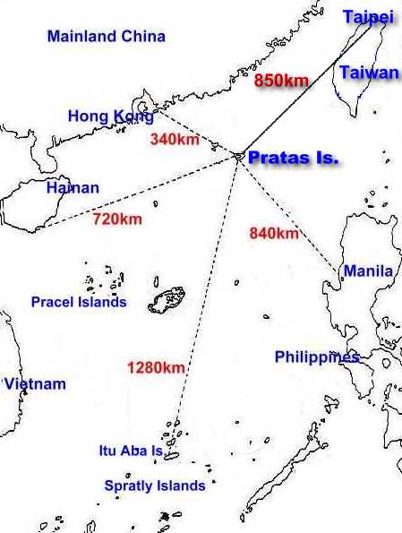
The coral reef has a diameter of approximately 25 km and is mostly under
water during high tide. It is situated some 320 km southeast of Hong Kong, 400
km south west of Taiwan and 840 km to the northwest of Manila in the northern
part of the South China Sea at 20°43' North and 116°42' East. Only the
horseshoe-shaped Dongsha- or Tung-Sha-Dao (like East Sand) is above the water
all the time. It measures 900m (from east to west) and 2.8 km (from north to
south) and reaches its maximum altitude at a height of about 300m. The reefs
North and South Vereker Bank (Pei Wie Tan and Nan Wie Tan) belong to this island
group, too. The climate is subtropical which means that the highest temperatures
are 30° Celsius in June and 22° Celsius in December with a high humidity all the
time.
The first people settled on the islands during the Ming dynasty founding the
very first settlement in the South China Sea at all.
Pratas is under Taiwanese administration, they have stationed military per-
sonnel on this strategically important island in the entry of the Taiwanese
Strait for 40 years now. Barbed wire and concrete dugouts can be found all over
the island between coconut trees. On June 30, 1989, a monument was erected
claiming the posession of the island and a year later an airport was built.
During March and April the islands are the destination of hundreds of fishermen
who then enjoy some service opportunities there. There is practi- cally no
tourism on Pratas.
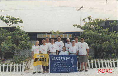
Amateur radio: Prefix BV9P, own DXCC entity since Jan 1, 1994, IOTA AS-110,
locator grid OL80. The first activity by Martti Laine, OH2BH, back in Jan 1994
lasted only two hours, other DXpeditions followed in 1994, 95 and 1998.
<DX-NL 1233 - February 26, 2001>
|

.jpg)
.jpg)