CE0/X       SAN FELIX & SAN AMBROSIO

ÃÖÁ¾¼öÁ¤ÀÏ 2002³â 11¿ù 02ÀÏ


 CAPITAL


 PREFIX

 CE0X

 CONTINENT

 SA

 ZONE

 CQ : 12      ITU : 14

 IOTA

 SA-013

 BEAM

 72/252

 QSL Bureau


 »ê Æ縯½º  <SAN FELIX>

 San Felix Island - lies at 26°16' S, 80°07' W, about 1000 km west of the continental coast of Chile.  It is about 2 km  long with 50-m vertical cliffs on the S side,  sloping to a single beach on the N side. It is volcanic, with numerous differentiated flows and extensive pyroclastic debris.
There is little vegetation. The island is occupied by the Chilean navy. <2002 XR0X QSL CARD>

 XQ0X

 XQ0X, SAN FELIX ISLAND. Mike, N6MZ, provided the following update: "The San Felix 2002 DXpedition is on schedule to hit the airwaves around March 17th, with radio operations continuing for approximately 12-14 days. Expedition leader Carlos, NP4IW/CE3AQI, arrived in Chile on Tuesday, March 5th, and is busy making final preparations; the rest of the 13-person team will arrive later this week. Departure from Valparaiso is scheduled for March 12th, and the vessel is scheduled to make port at Isla Juan Fernandez (CE0Z) during the outbound voyage. Please see the expedition web site http://www.cordell.org/SFX/ for for more information on frequencies and operating plans. Radio operations manager Mike, N6MZ, worked closely with the Ducie Island expedition team to coordinate frequencies and splits, given that both expeditions will be on the air simultaneously. The teams hope that this coordination will maximize the success of both operations. The web site will contain a Web Log QSO search and frequent news updates, both thanks to our USA pilot Dr. Bill, K6GNX, and our EU pilot Klaus, DL1XX. The San Felix 2002 DXpedition is being undertaken in conjunction with Cordell Expeditions (Robert Schmieder, KK6EK), a nonprofit organization that has carried out expeditions to remote sites for more than 20 years. Contributions made to the expedition through Cordell Expeditions are eligible for income tax deductions as a donation to a 501( c )( 3 ) organization. Some expedition expenses will be quite large (for example, use of the Chilean Navy's helicopter), so your contributions are still needed and will be greatly appreciated."    <Ohio/Penn DX Bulletin No. 553 March 11, 2002>

 San Ambrosio

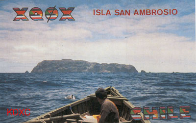
 Besides San Felix and Gonzalez, the 'Isla San Ambrosio' belongs to the island group Islas Desventuradas ("Dry Islands"). They are situated some 1100 km west of the Chilenian northern coast at 26°20'S, 80°10'W. The whole archipelago is only about 3,3 sq km big. West of San Ambrosio one can find the rock Roca Conica, in the East Roca Bass and the four Rocas Mas Afuerra.

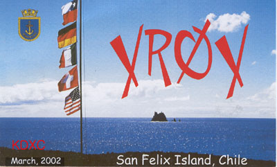
Like said by the Spanish name there is no water there. The only plants growing on the island are bushes and cacti. The only animals living there are sea birds, lizards and turtles. The climate is hot and dry and except from some fishermen coming only for a few days these islands are uninhabited at all.

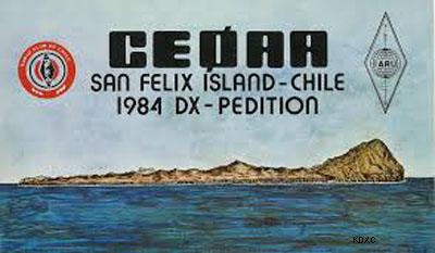
Some sources state that this island group has been discovered by Ferdinand Magellan after he passed the Magellan Strait on Noc 27, 1521 and sailing to the northwest for three months and 20 days. The first land he saw within the Pacific were only two uninhabited rocks! So he named them Desventuradas.

The island group is situated within CQ zone 12, ITU zone 14, IOTA number is SA-013. The time difference to UTC is minus 4 hours.


Copyright ¨Ï2001- 2015   Korea DX Club. All rights reserved.