V7       MARSHALL Is.

ÃÖÁ¾¼öÁ¤ÀÏ 2002³â 01¿ù 10ÀÏ


 CAPITAL

 MAJURO

 PREFIX

 V7

 CONTINENT

 OC

 ZONE

 CQ : 31      ITU : 65

 IOTA


 BEAM

 114/294

 QSL Bureau


 DELETED


 ¸¶¼È  <Marshall>

 ÅÂÆò¾ç Áß¼­ºÎ¿¡ ÀÖ´Â ³ª¶ó·Î¼­ Á¤½Ä¸íĪÀº ¸¶¼ÈÁ¦µµ°øÈ­±¹(Republic of the Marshall) ÀÌ´Ù. ¹ÌÅ©·Î³×½Ã¾Æ(V6) µ¿ºÎ ÇØ¿ª¿¡ À§Ä¡ÇÑ ¼¶µé·Î ÀÌ·ç¾îÁ® ÀÖ´Ù. ÇÏ¿ÍÀÌ¿¡¼­ ³²¼­ÂÊÀ¸·Î 2,100 km ¶³¾îÁ® ÀÖ´Ù.


 Kwajalein Archipelago

 The Kwajalein Atoll is situated at 167°43'East and 8°43'North in the Pacific Ocean, approximately 3400km Southwest of Hawaii and 2250km East of Guam. Kwajalein geographically belongs to the Ralik Chain (aka Sunset Islands) and thus is part of the Marshall Islands. The Kwajalein Archipelago covers an area of about 1.300 sqkm and is the biggest archipelago in the Pacific Ocean consisting of 90 islands. The climate is tropical averaging at 26° Celsius.

The Marshall Islands were under German authority from 1884 till 1918. The headquarter was on Jaluit the main island. After World War II the Americans built up a large base on it. Nowadays there are several thousand American soldiers working at world's largest radar site or with the missile defense. Even the majority of the native inhabitants are working for US government.

Economically the Marshalls are not that important. They are fishing, selling kopra or stamps. The USA are supporting them tremendously with development aid and compensations for the nuclear testing site on the neighbouring archipelagos Bikini and Eniwetok. They have almost no tourism though the Kwajalein archipelago belongs to the most beautiful diving sites in the world.

Amateur radio: Prefix V7, DXCC Marshall Islands, UTC+12 hours, WAZ zone 31, ITU zone 65. Marshall Islands are on rank 73 of the German Most Wanted List.      <DX-NL 1249 - June 18, 2001>

 ENEWETAK ATOLL

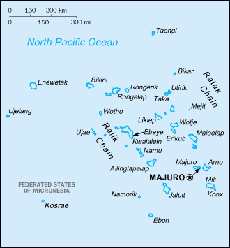
 The Enewetak-Atoll is located at 11° 30'N and 162° 20'E in the northwestern area of the Marshall Islands in the Pacific Ocean. 40 small and sandy, only 6m high these islands make up a circle with a circumference of 80km around a lagoon with a diameter of 37km. Together with Bikini, Kwajalein and Rongelap Enewetak belongs to the Ralik chain, also known as the Sunset Islands.

In the 1944 US army captured this atoll from Japan, moved the inhabitants to Ujelang Island and built a naval base there. From 1948 to 1956 they made some nuclear tests there (like on Bikini) and in 1980 the inhabitants were allowed to return to their island after it has been "decontaminated".

The Marshall Islands became independent in 1986. Their official language is English besides the Micronesian tongues spoken also.

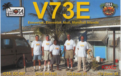
Amateur radio: prefix V7, DXCC: Marshall Islands (rank 73 on Germany's Most Wanted), IOTA: OC-087, UTC +12h, WAZ zone 31, ITU zone 65.     <DX-NL 1239 - April 9, 2001>


Copyright ¨Ï2001- 2015   Korea DX Club. All rights reserved.